Mountains are more than just geological formations; they are the planet’s silent, towering sentinels, shaping climates, cradling biodiversity, and inspiring human culture for millennia. From the razor-sharp peaks that challenge the world’s most daring adventurers to the serene slopes that have become centers of spiritual pilgrimage, these natural wonders command respect and awe. This comprehensive guide explores the geology, ecology, and cultural significance of the most famous mountain ranges across the globe, offering a deep dive into the forces that created them and the profound impact they have on life on Earth.
We will journey from the “Roof of the World” in Asia to the continental backbone of South America, cross the great divide of North America, and explore the cultural heart of Europe. We will also venture into the sacred and artistically inspiring landscapes of China’s most revered peaks. Each mountain range tells a unique story of tectonic power, climatic influence, and human history, revealing why these majestic landscapes continue to captivate and define our world.
The Himalayas: The Majestic Roof of the World
The Himalayas, whose name means “abode of snow” in Sanskrit, represent the most formidable and awe-inspiring mountain range on Earth. Stretching approximately 2,400 kilometers across five nations—India, Nepal, Bhutan, China (Tibet), and Pakistan—this range is a testament to the immense power of plate tectonics. It is home to the planet’s highest peaks, including the legendary Mount Everest.
Geological Formation and Unrelenting Growth
The formation of the Himalayas is a dramatic story of continental collision. About 50 million years ago, the Indian subcontinent, drifting northward, collided with the Eurasian Plate. Because both landmasses had similar rock density, one could not be subducted under the other. Instead, the continental crust buckled, folded, and faulted, thrusting rock skyward to form the towering peaks we see today. This process is far from over; the Indian Plate continues to push into the Eurasian Plate, causing the Himalayas to grow by approximately 5 millimeters per year. This constant geological activity also makes the region seismically active.
Mount Everest: The Ultimate Terrestrial Challenge
Dominating the Himalayan landscape is Mount Everest, the world’s highest peak, standing at a staggering 8,848.86 meters (29,031.7 feet) above sea level. Known as Sagarmatha in Nepal and Chomolungma in Tibet, it represents the pinnacle of mountaineering achievement. Climbing Everest is an extreme undertaking due to its severe conditions:
- Thin Atmosphere: At the summit, the oxygen level is only about one-third of that at sea level, making acclimatization critical and the use of supplemental oxygen standard for most climbers.
- Extreme Weather: The peak is battered by the jet stream for much of the year, with wind speeds exceeding 200 mph. Temperatures can plummet to -60°C (-76°F).
- Technical Difficulty: Climbers must navigate treacherous terrain, including the Khumbu Icefall, a constantly shifting river of ice, and the final push along narrow, exposed ridges. The two primary routes are the Southeast Ridge from Nepal, pioneered by Sir Edmund Hillary and Tenzing Norgay in 1953, and the Northeast Ridge from Tibet.
Cultural and Ecological Significance
The Himalayas are not just a physical barrier but also a cultural and spiritual nexus. They are sacred in Hinduism and Buddhism, dotted with monasteries and temples. The range is also the source of Asia’s most vital rivers, including the Indus, Ganges, and Brahmaputra, which provide water for billions of people. Its diverse ecosystems range from subtropical forests at the foothills to alpine meadows and barren, icy peaks, supporting unique wildlife such as the snow leopard and the red panda.

The Andes: The Continental Backbone of South America
Stretching over 7,000 kilometers along the western coast of South America, the Andes are the longest continental mountain range in the world. This immense chain passes through seven countries: Venezuela, Colombia, Ecuador, Peru, Bolivia, Chile, and Argentina. It acts as a massive continental divide, profoundly influencing the continent’s climate, biodiversity, and human history.
Tectonic Origins and Volcanic Activity
The Andes were formed by the process of subduction, where the oceanic Nazca Plate and Antarctic Plate slide beneath the continental South American Plate. This ongoing collision has not only uplifted the mountains but also created the Peru-Chile Trench offshore. The immense geological pressure and heat have resulted in a high degree of volcanic activity, with numerous active volcanoes dotting the range. This process has also made the region rich in mineral deposits, including copper, gold, and silver, which have been exploited for centuries.
A Spectrum of Climates and Ecosystems
Due to their vast length and varying altitudes, the Andes host an incredible diversity of climates and ecosystems. In the north, they are home to tropical rainforests and cloud forests. The central Andes feature high-altitude plateaus like the Altiplano in Peru and Bolivia, which is one of the most extensive high-altitude plateaus outside of Tibet. Further south, the range becomes more rugged and glaciated, terminating in the dramatic landscapes of Patagonia. This environmental diversity has fostered an extraordinary level of biodiversity, making the tropical Andes a designated global biodiversity hotspot.
Legacy of Ancient Civilizations
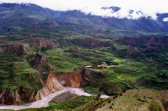
The Andes were the cradle of some of South America’s most advanced ancient civilizations, most notably the Inca Empire. The Incas masterfully adapted to the challenging mountain environment, building extensive road networks, terraced farms (andenes), and stone cities like the world-famous Machu Picchu. The mountains continue to be home to millions of indigenous people who maintain traditional lifestyles, speaking languages like Quechua and Aymara and practicing agricultural techniques passed down through generations.

The Rocky Mountains: North America’s Great Divide
The Rocky Mountains, often called the Rockies, are a colossal mountain range in western North America. Extending more than 4,800 kilometers (3,000 miles) from the northernmost part of British Columbia, Canada, to New Mexico in the United States, they form the Continental Divide. This hydrological divide separates the waters that flow to the Atlantic and Arctic oceans from those that flow to the Pacific Ocean.
Formation and Geological Complexity
The Rockies were primarily formed during the Laramide orogeny, an intense period of mountain-building that began around 80 million years ago. Unlike the Andes, which were formed by a simple plate collision at the coast, the Rockies were formed much farther inland. This was caused by the Farallon Plate subducting at a very shallow angle under the North American Plate, creating friction and uplift far from the plate boundary. Subsequent glaciation during the Ice Ages carved the sharp peaks, deep valleys, and dramatic cirques that characterize the range today.
A Mosaic of Ecosystems and National Parks
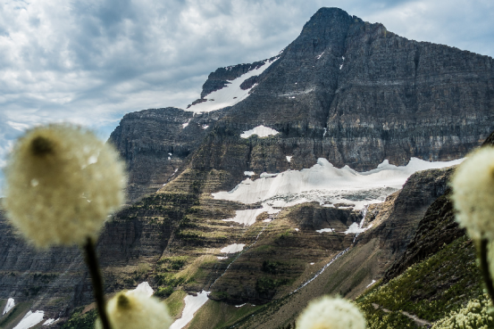
The Rockies are renowned for their pristine natural beauty and are protected by numerous national parks, including Yellowstone, Glacier, and Rocky Mountain National Parks in the U.S., and Banff and Jasper National Parks in Canada. These parks preserve a wide array of ecosystems, which are defined by altitude:
- Montane Zone: Characterized by wide valleys and open forests of ponderosa pine and Douglas fir.
- Subalpine Zone: Dominated by dense forests of Engelmann spruce and subalpine fir, leading up to the treeline.
- Alpine Tundra: Above the treeline, this harsh environment is home to hardy, low-growing plants and animals adapted to extreme cold and wind.
This diverse environment supports iconic North American wildlife, including grizzly bears, elk, bighorn sheep, and mountain lions.

The Alps: The Cultural and Geographic Heart of Europe
The Alps are the highest and most extensive mountain range system that lies entirely in Europe, stretching approximately 1,200 kilometers across eight Alpine countries: France, Switzerland, Italy, Monaco, Liechtenstein, Austria, Germany, and Slovenia. They are a crucial geographical feature that has shaped European climate, culture, and history.
Collision of Continents and Glacial Sculpting
Similar to the Himalayas, the Alps were formed by the collision of two continental plates—the African and Eurasian Plates. This immense pressure folded and pushed up the seabed, creating the distinctive rock formations of the Alps. The range is home to iconic peaks such as Mont Blanc (the highest peak in the Alps at 4,809 meters) and the Matterhorn, famous for its near-perfect pyramidal shape. Like the Rockies, the Alps’ modern landscape was heavily sculpted by glaciers, which carved out U-shaped valleys, sharp arêtes, and deep freshwater lakes like Lake Geneva and Lake Como.
A Hub for Tourism and Culture
The Alps are one of the world’s most popular tourist destinations, attracting millions of visitors for skiing, hiking, and mountaineering. The birth of modern alpinism is deeply rooted in this range. Beyond recreation, the Alps are a vital economic region, supporting industries from agriculture and forestry to hydroelectric power generation. The cultural landscape is incredibly diverse, with distinct traditions, languages, and cuisines found in different Alpine valleys, reflecting centuries of human adaptation to mountain life.

China’s Iconic Peaks: A Fusion of Nature and Culture
In China, mountains are not just geographical features but are deeply embedded in the nation’s culture, art, and spirituality. Certain mountains are revered for their historical significance and breathtaking beauty, representing a profound connection between humanity and nature.
The Five Great Mountains: Pillars of Taoist Tradition
The Five Great Mountains are a collection of peaks that hold immense significance in Chinese history and are central to Taoism. For centuries, emperors made pilgrimages to these mountains to pay homage to the heavens. Each mountain corresponds to a cardinal direction:
- Mount Tai (East): Associated with sunrise and birth, it is considered the most sacred of the five and was a site of imperial coronations.
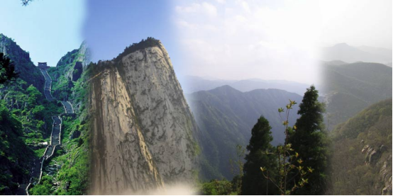
- Mount Hua (West): Known for its precipitous cliffs and famously dangerous hiking trails.
- Mount Heng (South, in Hunan): Renowned for its scenic beauty and lush vegetation.
- Mount Heng (North, in Shanxi): A key center for Taoism, featuring the famous Hanging Monastery.
- Mount Song (Central): Home to the renowned Shaolin Temple, the birthplace of Zen Buddhism and Kung Fu.
Huangshan (Yellow Mountain): A Landscape from a Painting
Though not one of the Five Great Mountains, Huangshan is arguably China’s most famous and visually stunning mountain. Its landscape has inspired countless poets and painters for centuries. Huangshan is renowned for its “Four Wonders”:
- Strangely-shaped granite peaks: Weathered over millions of years into fantastical shapes.
- Gnarled pine trees: Growing directly from the rock, often in seemingly impossible positions.
- The Sea of Clouds: A phenomenon where clouds fill the valleys below, creating the illusion of an archipelago of mountain islands.
- Hot springs: Offering therapeutic relaxation amidst the dramatic scenery.
The unique beauty of Huangshan has made it a UNESCO World Heritage Site and a powerful symbol of Chinese landscape aesthetics.

The Global Significance of Mountain Ecosystems
Beyond their individual characteristics, mountain ranges worldwide play a critical role in sustaining global environmental health. They are indispensable to life on Earth, acting as “water towers,” regulators of climate, and havens for biodiversity.
Mountains as Cradles of Biodiversity
The rapid changes in altitude, temperature, and sun exposure over short distances in mountains create a wide variety of microclimates and habitats. This environmental diversity allows a vast number of species to coexist, making mountain regions some of the most biodiverse places on the planet. Many species found in mountains are endemic, meaning they exist nowhere else. This makes their conservation a global priority, as they are particularly vulnerable to climate change.
Regulators of Global Climate and Water Cycles
Mountains significantly influence weather patterns. They act as barriers to prevailing winds, forcing air to rise, cool, and release moisture as rain or snow. This process, known as orographic lift, creates wet conditions on the windward side and arid “rain shadows” on the leeward side. Furthermore, mountain glaciers and snowpack act as natural reservoirs, storing fresh water and releasing it gradually during warmer months. This meltwater feeds major river systems, providing essential water for drinking, agriculture, and industry for a significant portion of the world’s population.
Frequently Asked Questions (FAQ)
- Q1: What is the geological difference between the formation of the Himalayas and the Andes?
- The primary difference lies in the types of tectonic plates that collided. The Himalayas were formed by a continent-continent collision between the Indian and Eurasian plates. Since both have similar density, the crust buckled and folded upwards. The Andes, on the other hand, were formed by a continent-ocean collision, where the denser oceanic Nazca Plate subducted, or slid beneath, the lighter continental South American Plate, causing volcanic uplift.
- Q2: Why is Mount Everest’s height sometimes listed differently?
- Mount Everest’s official height was most recently updated in 2020 to 8,848.86 meters (29,031.7 feet). Previous measurements varied due to different survey techniques, the challenge of measuring the snow level versus the rock level at the summit, and the ongoing geological uplift of the mountain range. The 2020 measurement was a joint effort by China and Nepal and is considered the most accurate to date.
- Q3: Which mountain range is considered the longest in the world?
- The Andes are the longest continental mountain range, at approximately 7,000 km. However, the longest mountain range on Earth is actually the mid-ocean ridge system, which stretches for about 65,000 km (40,000 miles) around the globe, almost entirely underwater.
- Q4: How do mountains like the Alps and Rockies impact local weather?
- Mountains create what is known as the rain shadow effect. As moist air from an ocean moves inland and encounters a mountain range, it is forced to rise. As it rises, it cools, and the moisture condenses into rain or snow on the windward side of the mountains. By the time the air mass crosses over the peaks to the leeward side, it has lost most of its moisture, resulting in a much drier, often arid or semi-arid, climate on the other side.
- Q5: What makes China’s Five Great Mountains so culturally significant?
- Their significance is deeply rooted in ancient Chinese religion, philosophy, and political history. In Taoism, they are seen as sacred sites where the gods reside and where one can communicate with the heavens. For centuries, Chinese emperors would make pilgrimages to these mountains, particularly Mount Tai, to perform rituals that legitimized their rule and ensured prosperity for the empire. This has imbued them with a profound cultural and spiritual importance that transcends their physical geography.