The Geological Marvel: How Volcanoes Shape Mighty Mountains
The genesis of a mountain is rarely a quiet event; it is often the result of violent, earth-shattering geological processes that span millions of years. Among the most dramatic of these processes is volcanic activity. Unlike fold mountains, which are created by the slow collision of tectonic plates, volcanic mountains are born from the accumulation of erupted materials. Deep within the Earth’s mantle, extreme heat melts rock to form magma. When tectonic shifts or immense subterranean pressure force this magma upward through weaknesses in the Earth’s crust, an eruption occurs. This initial breach is merely the first step in a prolonged architectural endeavor by nature to build a mighty peak.
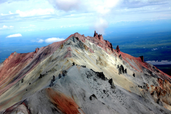
Understanding the architecture of volcanic mountains requires a deep dive into the types of materials expelled during these eruptions. Magma, once it breaches the surface, is referred to as lava. The viscosity, chemical composition, and gas content of this lava dictate the physical structure of the resulting mountain. Highly viscous lava, rich in silica, tends to trap gases, leading to explosive eruptions that eject ash, cinders, and pumice. These materials fall back to earth, layering with subsequent slow-moving lava flows to create towering, steep-sided stratovolcanoes. Conversely, basaltic lava, which is low in silica and highly fluid, flows over vast distances before cooling, resulting in the broad, gently sloping profiles of shield volcanoes.
The Tectonic Engine: Subduction and Rift Zones
The geographical distribution of volcanic mountains is not random; it is intricately tied to the boundaries of tectonic plates. The majority of the world’s most imposing volcanic peaks are located along subduction zones, such as the infamous Ring of Fire encircling the Pacific Ocean. In these volatile regions, a dense oceanic plate is forced beneath a lighter continental plate. As the descending plate plunges into the superheated mantle, it undergoes partial melting, generating buoyant magma that relentlessly pushes toward the surface.
- Subduction Zones: Characterized by highly explosive stratovolcanoes (e.g., Mount St. Helens, Mount Fuji). The interaction of water-rich oceanic crust with the mantle creates highly pressurized, silica-rich magma.
- Divergent Boundaries: Occur where tectonic plates pull apart, such as the Mid-Atlantic Ridge. Here, magma rises to fill the gap, creating extensive underwater mountain ranges and islands like Iceland.
- Hotspots: Anomalous regions of intense mantle heat that are completely independent of plate boundaries. As the tectonic plate drifts over the stationary hotspot, a chain of volcanic islands or seamounts is formed, exemplified by the Hawaiian Emperor seamount chain.

Magma, Lava Flows, and the Accumulation of Elevation
The transformation from a flat landscape or a minor fissure to a mighty mountain is a cumulative process driven by successive lava flows. Each eruption adds a new layer to the volcanic edifice. When lava flows out of a central vent or lateral fissures, it interacts immediately with the atmosphere or ocean, beginning a rapid cooling process. The outer skin of the lava flow solidifies quickly, forming an insulating crust that allows the molten rock inside to continue flowing downhill. This mechanism enables lava to travel significant distances, thereby broadening the base of the mountain while simultaneously increasing its elevation.
The structural integrity of a volcanic mountain is highly dependent on the interplay between constructive volcanic eruptions and destructive forces such as erosion and gravitational collapse. Igneous rock, formed from cooled lava, is generally incredibly hard and resistant to weathering. Over millennia, layers of this hardened rock alternate with strata of compacted ash and tephra. This stratification provides the mountain with both bulk and height, though the looser ash layers can become points of structural weakness, occasionally leading to massive landslides or sector collapses during particularly violent eruptions.
The Cooling Process and Igneous Rock Formation
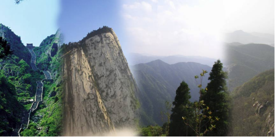
The microscopic and macroscopic characteristics of the mountain’s bedrock are determined by the specific cooling rates of the lava. When lava cools rapidly on the surface, it forms extrusive igneous rocks with fine-grained textures, such as basalt or andesite. If the magma cools slowly beneath the surface, it forms intrusive igneous rocks with large, visible crystals, like granite or diorite. As erosion strips away the softer exterior layers of ancient, dormant volcanoes, these hardened intrusive cores are often left exposed as dramatic, sheer-sided geological monoliths.

Altitudinal Zonation: Decoding Mountain Climate Transitions
One of the most fascinating ecological phenomena observed in mountainous regions is altitudinal zonation. As you ascend a mountain, the environmental conditions change drastically, mimicking the climatic shifts you would experience traveling from the equator toward the poles. This transition is primarily governed by the environmental lapse rate—the rate at which atmospheric temperature decreases with an increase in altitude. On average, the temperature drops by about 6.5°C for every 1,000 meters of elevation gained. This fundamental thermodynamic principle dictates that a single mountain can host a multitude of distinct climate zones, each supporting its own unique biosphere.
At the base of the mountain, particularly in lower latitudes, the climate is typically temperate or even tropical. Here, dense deciduous or broadleaf forests thrive, supported by deep soils, abundant rainfall, and long growing seasons. However, as elevation increases, the air becomes thinner, retaining less heat. The growing season shortens, and precipitation patterns shift, often resulting in heavier snowfall. These changing abiotic factors force a radical transition in the flora and fauna, creating distinct horizontal bands of life that wrap around the mountain’s topography.
The Progression of Ecological Zones
The shift from temperate valleys to arctic-like peaks is not gradual but rather punctuated by distinct ecological thresholds. The most prominent of these is the treeline, the highest elevation at which trees can survive. Beyond this point, the harsh winds, freezing temperatures, and thin soils make arboreal life impossible.
| Climate Zone | Approximate Elevation Range | Flora Characteristics | Climate Profile |
|---|---|---|---|
| Temperate/Montane | Base to 1,500m | Deciduous forests, rich undergrowth, diverse canopy. | Warm summers, mild winters, moderate precipitation. |
| Subalpine | 1,500m to 2,500m | Coniferous forests (pines, firs), hardy shrubs. | Short summers, long freezing winters, heavy snow. |
| Alpine | 2,500m to 3,500m | Grasses, sedges, low-lying alpine flowers, mosses. | High winds, frequent frosts, high UV radiation. |
| Nival (Arctic) | Above 3,500m | Lichens, isolated mosses, completely barren rock. | Permanent snow/ice, sub-zero average temperatures. |

Extreme Altitudes: Surviving the Arctic-Like Peaks
Reaching the nival zone—the uppermost tier of a high-altitude mountain—is akin to stepping into the Arctic Circle. This region is characterized by permanent snowfields, massive glaciers, and exposed, frost-shattered bedrock. The atmosphere here is incredibly thin, meaning oxygen levels are drastically reduced, and the barrier against solar radiation is minimal. Consequently, organisms living at these extreme altitudes face a dual threat: blistering ultraviolet radiation during the day and life-threatening, sub-zero temperatures at night.
The biological adaptations required to survive in this arctic-like transition zone are nothing short of miraculous. Flora is virtually non-existent, save for incredibly resilient extremophiles like certain species of lichens that can photosynthesize at temperatures well below freezing. Fauna is sparse, limited to highly adapted species such as the snow leopard or the Himalayan tahr, which possess enlarged lungs for efficient oxygen extraction, thick insulating coats, and specialized hemoglobin to maximize oxygen transport in the blood. The ecosystem here operates on a razor’s edge, entirely dependent on the fragile balance of the mountain’s microclimate.
Permafrost and Glacial Environments
The geological and climatic realities of the nival zone are dominated by ice. Permafrost—ground that remains completely frozen for two or more consecutive years—acts as a binding agent for the mountain’s upper scree slopes. Meanwhile, glaciers act as slow-moving rivers of ice, carving deep U-shaped valleys and grinding bedrock into fine rock flour. These massive ice reservoirs are not just static features; they are dynamic, sensitive indicators of global climate health, and they play a critical role in the mountain’s hydrological cycle.

Mountain Hydrology: The Birth of Streams and Rivers
Mountains are universally recognized as the “water towers” of the world. Their imposing physical presence forces moisture-laden air masses to rise, cool, and condense, resulting in high levels of precipitation—a phenomenon known as orographic lift. This abundant precipitation falls as rain in the lower temperate zones and as heavy snow in the subalpine and alpine zones. The complex hydrological systems within mountainous areas begin with the capture and storage of this precipitation, which is then gradually released to form the intricate networks of streams, rivers, and aquifers that sustain life far beyond the mountain’s base.
The formation of mountain streams is a multi-faceted process driven by gravity and topography. In the spring and summer, rising temperatures trigger the melting of the winter snowpack and the lower edges of permanent glaciers. This meltwater percolates through the porous alpine soils and fractured bedrock, eventually emerging at the surface as natural springs. These springs coalesce into small, fast-flowing rivulets that carve their way down the steep gradients. Because of the high gradient, mountain streams possess immense kinetic energy, allowing them to erode deep V-shaped valleys and transport significant quantities of sediment downstream.
Snowmelt, Runoff, and Groundwater Seepage
The consistency and volume of mountain streams rely heavily on a delicate balance of surface runoff and groundwater seepage. While sudden rainstorms can cause rapid, flashy runoff, it is the slow, steady release of glacial meltwater and deep groundwater that ensures streams flow continuously throughout dry seasons.
- Glacial Runoff: Provides a critical baseline flow during the hottest months of late summer when seasonal snow has already melted. This water is typically milky in appearance due to suspended glacial rock flour.
- Snowpack Melt: Acts as a natural reservoir, holding winter precipitation and releasing it gradually during the spring thaw, triggering the annual swelling of mountain rivers.
- Groundwater Discharge: Water that has infiltrated deep into the mountain’s bedrock fractures slowly makes its way to the surface, providing highly filtered, cold, and mineral-rich water to alpine springs.

The Mechanics of Waterfalls and Alpine Lakes
As mountain streams violently descend through steep, rugged terrain, they frequently encounter variations in bedrock resistance. This geological heterogeneity is the primary catalyst for the formation of waterfalls. When a fast-flowing stream crosses a layer of hard, erosion-resistant rock onto a softer, more easily eroded rock layer, the softer rock is worn away at a much faster rate. Over centuries, this differential erosion creates a sharp drop-off, or knickpoint, in the streambed. Gravity takes over, pulling the water down in a spectacular free-fall, birthing a waterfall.
The sheer force of the falling water, combined with abrasive rocks and sediment carried in the current, relentlessly pounds the base of the waterfall. This hydraulic action and abrasion carve out a deep, turbulent basin known as a plunge pool. As the plunge pool deepens and widens, it undercuts the hard rock ledge above, eventually causing it to collapse. This continuous cycle of undercutting and collapse causes the waterfall to slowly migrate upstream, leaving a steep gorge in its wake. In addition to waterfalls, mountain hydrology is characterized by stunning alpine lakes, which serve as vital high-altitude reservoirs.
The Formation of Cirque and Moraine-Dammed Lakes
Alpine lakes are predominantly the legacy of past and present glacial activity. They not only add to the aesthetic majesty of the mountain landscape but also act as crucial settling basins that regulate water flow and filter sediments.
- Cirque Lakes (Tarns): Formed in the deep, bowl-shaped amphitheaters carved out by the heads of glaciers. When the ice retreats, meltwater fills the depression, creating a pristine, circular lake surrounded by steep cliffs.
- Moraine-Dammed Lakes: As glaciers bulldoze their way down valleys, they push massive mounds of rock and debris known as moraines. When the glacier melts, these terminal moraines act as natural dams, trapping meltwater behind them to form elongated lakes.

The Interconnected Web of Geology, Climate, and Water
To truly understand mountain ecosystems, one must view them not as isolated phenomena, but as a deeply interconnected web where geology, climate, and hydrology are in constant dialogue. The geological formation of the mountain dictates its elevation and topography. In turn, this topography disrupts global atmospheric circulation, creating the highly stratified altitudinal climate zones. Finally, these specific climate zones—dictating whether precipitation falls as rain or is locked away as glacial ice—govern the entire hydrological system of the region.
This dynamic equilibrium is incredibly powerful yet remarkably fragile. For instance, tectonic uplift continues to push young mountains higher, which can intensify orographic precipitation and expand the nival zone. Conversely, shifting global climate patterns can accelerate the melting of alpine glaciers, drastically altering the timing and volume of streamflow. This not only threatens the survival of highly specialized alpine flora and fauna but also jeopardizes the water security of millions of human inhabitants living in the downstream watersheds. The mountain is a living, breathing system where every rock, drop of water, and gust of wind plays a critical role in sustaining the whole.
How Topography Dictates Microclimates
The orientation of a mountain slope relative to the sun and prevailing winds introduces another layer of complexity known as the microclimate. The windward side of a mountain receives the brunt of incoming moisture, resulting in lush vegetation and dense stream networks. In stark contrast, the leeward side sits in a “rain shadow,” experiencing descending, dry air that creates arid, desert-like conditions. Similarly, south-facing slopes in the Northern Hemisphere receive more direct sunlight, leading to warmer soils and higher treelines compared to the cooler, heavily glaciated north-facing slopes.

Frequently Asked Questions (FAQ)
Navigating the complex interplay of volcanic formation, climate zonation, and hydrological networks can be challenging. Below, we have compiled detailed answers to some of the most pressing questions regarding mountain ecosystems.
Frequently Asked Questions (FAQ)
- How do stratovolcanoes differ from shield volcanoes in their formation?
- Stratovolcanoes are formed by highly viscous, silica-rich lava that traps gases, leading to explosive eruptions. These eruptions deposit alternating layers of hardened lava, volcanic ash, and pumice, creating steep, towering profiles. Shield volcanoes, on the other hand, are formed by fluid, basaltic lava that flows easily over vast distances before cooling. This creates broad, gently sloping mountains that resemble a warrior’s shield laid flat on the ground.
- Why does the climate change so drastically as you climb a mountain?
- The drastic climate change is driven by the environmental lapse rate. As altitude increases, atmospheric pressure drops, causing the air to expand and cool. On average, the temperature decreases by about 6.5°C for every 1,000 meters of elevation. This rapid cooling, combined with increased wind exposure and thinner atmosphere, forces the environment to transition from temperate conditions at the base to arctic-like conditions at the summit, creating distinct ecological zones.
- What is the “treeline” and what causes it?
- The treeline is the highest elevation on a mountain where trees are capable of growing. Above this critical threshold, environmental conditions become too severe for arboreal survival. The primary limiting factors are excessively cold temperatures, short growing seasons, permafrost which prevents deep root growth, and high winds that cause severe desiccation (drying out) of plant tissues.
- How do mountain streams maintain their flow during dry summer months?
- While surface runoff from immediate rainfall contributes to streamflow, the consistent flow during dry periods is primarily sustained by the delayed release of water from two sources: the melting of high-altitude glaciers and the slow seepage of deep groundwater. Snowpack acts as a reservoir that melts slowly through spring and early summer, while deep bedrock aquifers release filtered water at a steady rate year-round.
- What is a plunge pool, and how does it contribute to waterfall migration?
- A plunge pool is a deep basin carved at the base of a waterfall by the immense erosive force of cascading water and the abrasive sediment it carries. As the plunge pool is continuously excavated, it undercuts the harder, erosion-resistant rock ledge above it. Eventually, lacking support, the overhanging ledge collapses into the pool. This continuous process of undercutting and collapse causes the waterfall to slowly move, or migrate, upstream over geological time.