Volcanic islands represent some of the most dynamic and visually stunning environments on Earth. Created by the raw power of tectonic activity and mantle hotspots, islands like Jeju, Hawaii, and Bali offer more than just scenic vistas; they are living laboratories of geology, evolution, and human adaptation. This pillar page provides an exhaustive exploration of these three distinct regions, detailing their unique natural attractions, scientific significance, and the cultural tapestries woven into their rugged landscapes.
Jeju Island: The Volcanic Masterpiece of South Korea
Jeju Island, situated off the southern coast of the Korean Peninsula, is a testament to the creative power of volcanic eruptions. Formed approximately 2 million years ago during the Cenozoic era, the island is dominated by Hallasan, a dormant shield volcano that serves as South Korea’s highest peak. Jeju’s designation as a UNESCO World Natural Heritage site is rooted in its incredibly well-preserved volcanic features, which provide a window into the Earth’s formative processes.
The Geomunoreum Lava Tube System
Perhaps the most scientifically significant feature of Jeju is the Geomunoreum Lava Tube System. Unlike typical caves, these tubes were formed by flowing basaltic lava. As the surface cooled and hardened, the molten rock underneath continued to flow, eventually draining out and leaving behind hollow, cathedral-like structures. The Manjanggul Cave is the most famous of these, stretching over 7 kilometers. Visitors can observe unique geological formations such as lava stalactites, lava columns, and “lava toes.” The cave maintains a consistent temperature between 11°C and 15°C, creating a micro-environment that supports rare cave-dwelling species.
Seongsan Ilchulbong: The Sunrise Peak
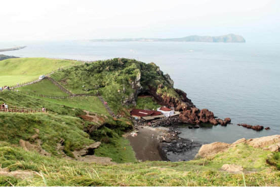
Located on the eastern edge of the island, Seongsan Ilchulbong is a classic example of a hydrovolcanic cone. It was formed about 5,000 years ago by an underwater eruption in shallow waters. The resulting structure is a massive, crown-like crater that rises 182 meters above sea level. The site is not only a geological marvel but also a cultural icon, famous for the breathtaking sunrise views from its rim. The surrounding cliffs provide a vertical cross-section of the volcanic strata, allowing geologists to study the specific phases of the eruption.
The Haenyeo Culture and Basalt Landscapes
The human history of Jeju is inextricably linked to its volcanic soil. The island is famous for its Haenyeo (female divers), who harvest seafood without oxygen tanks. This tradition reflects the community’s adaptation to an island where the rocky basaltic soil made traditional large-scale farming difficult. The ubiquitous black basalt rock is used in everything from the “Dol Hareubang” (stone grandfathers) to the intricate stone walls that protect crops from the island’s strong winds.

The Hawaiian Islands: A Scientific and Natural Frontier
The Hawaiian Archipelago is a 1,500-mile chain of islands formed by a “hotspot” in the Earth’s mantle. As the Pacific Plate moves northwest, new islands are birthed over this fixed thermal plume. This process has created a chronological sequence of islands, from the eroded atolls of the northwest to the geologically “young” and active Big Island in the southeast.
Volcanology at Hawaii Volcanoes National Park
Hawaii Volcanoes National Park is home to two of the world’s most active volcanoes: Kilauea and Mauna Loa. Kilauea is particularly significant for researchers because its eruptions are typically “effusive” rather than explosive, allowing for relatively safe, close-range observation of lava flows. The park features the Chain of Craters Road, which demonstrates the destructive and creative power of lava as it consumes forests and roads before adding new land to the coastline. Scientists use these sites to study planetary geology, as the basaltic flows closely resemble those found on Mars and the Moon.
Mauna Kea: The Gateway to the Universe
While often celebrated for its beaches, Hawaii is also a premier destination for astronomy. Mauna Kea, a dormant volcano on the Big Island, stands 4,207 meters above sea level. However, when measured from its base on the ocean floor, it is the tallest mountain in the world (over 10,000 meters). Its high altitude, dry atmosphere, and minimal light pollution make it the ideal location for the Mauna Kea Observatories. This site has been instrumental in discovering new exoplanets and studying the expansion of the universe.
The Na Pali Coast and Waimea Canyon
On the older island of Kauai, the forces of erosion have transformed volcanic rock into dramatic landscapes. The Na Pali Coast features emerald-green pinnacles rising 4,000 feet from the Pacific, carved by centuries of rainfall and wave action. Nearby, Waimea Canyon, known as the “Grand Canyon of the Pacific,” showcases deep red and orange soil layers, a result of the oxidation of iron-rich volcanic basalt. These areas demonstrate the final stages of a volcanic island’s lifecycle before it eventually sinks back into the sea.

Bali: The Intersection of Volcanic Power and Tropical Biodiversity
Bali, Indonesia, sits on the Sunda Arc, a volcanic chain formed by the subduction of the Indo-Australian Plate beneath the Eurasian Plate. Unlike the hotspot-formed islands of Hawaii, Bali’s volcanoes are part of a subduction zone, leading to more explosive and mineral-rich eruptions that have created some of the most fertile lands on the planet.
Mount Agung and Mount Batur
Mount Agung is the highest point in Bali and is considered the island’s most sacred mountain. It is an active stratovolcano that significantly impacts the local climate and agriculture. To the west lies Mount Batur, famous for its massive caldera containing a crescent-shaped lake. The Batur Global Geopark allows visitors to hike across vast lava fields from the 1963 and 1968 eruptions, illustrating the rapid pace of ecological succession as pioneer plants begin to colonize the nutrient-rich volcanic rock.
The Subak System and Agricultural Fertility
The fertility of Bali is directly tied to its volcanic heritage. Ash from eruptions provides a constant supply of minerals to the soil. This has enabled the development of the Subak irrigation system, a UNESCO World Heritage site. This complex water management system distributes water from volcanic lakes through forests and into terraced rice paddies, such as those at Tegalalang and Jatiluwih. The Subak system is a perfect example of Tri Hita Karana, the Balinese philosophy of harmony between the spirit, the human world, and nature.
Rainforests and Coastal Ecosystems
Bali’s volcanic topography creates distinct microclimates. The high central mountains trap moisture, feeding lush rainforests in areas like Ubud and the West Bali National Park. These forests are home to the endangered Bali Myna and long-tailed macaques. Meanwhile, the coastline features a mix of black volcanic sand beaches in the north and east (like Amed and Lovina) and white limestone-cliff beaches in the south (Uluwatu), showcasing the island’s diverse geological origins.

Comparative Analysis: Geological Profiles and Ecosystems
Understanding the differences between these three regions requires a look at their geological “engines.” While all are volcanic, their formations result in different landscapes and biological opportunities.
| Feature | Jeju Island | Hawaiian Islands | Bali |
|---|---|---|---|
| Volcanic Type | Shield Volcano / Scoria Cones | Hotspot Shield Volcanoes | Subduction Stratovolcanoes |
| Primary Rock | Basalt and Trachyte | Tholeiitic Basalt | Andesite and Basalt |
| Key Geological Wonder | Lava Tubes (Manjanggul) | Active Lava Flows (Kilauea) | Caldera Lakes (Batur) |
| Soil Fertility | Moderate (Porous Basalt) | Variable (Age-dependent) | Very High (Volcanic Ash) |
| Climate | Temperate/Subtropical | Tropical (Diverse Microclimates) | Tropical Monsoon |
The Hawaiian Islands represent a chronological progression of life, where species had to travel thousands of miles to colonize new land, leading to high rates of endemism. In contrast, Bali sits near the Wallace Line, acting as a bridge for Asian flora and fauna. Jeju serves as a temperate refugium, hosting species that are rare on the mainland due to its isolated maritime climate.

Strategic Planning for Volcanic Island Exploration
Visiting these regions requires careful planning to respect the fragile ecosystems and ensure safety near active geological sites. Here are the core strategies for a successful expedition:
- Safety Near Volcanic Vents: Always check local geological surveys (e.g., USGS for Hawaii, PVMBG for Indonesia). Volcanic gases like sulfur dioxide can be hazardous even if no lava is visible.
- High-Altitude Preparation: When visiting Mauna Kea or Mount Agung, allow time for acclimatization. Temperatures at high altitudes can drop below freezing, even in the tropics.
- Eco-Conscious Travel: Use reef-safe sunscreen in Hawaii and Bali to protect coral reefs. On Jeju, stay on marked trails to prevent the erosion of soft scoria (volcanic cinder) soil.
- Cultural Protocol: Many volcanic peaks are considered sacred. In Bali, visitors must wear a sarong and sash when entering temple grounds on mountain slopes.

Frequently Asked Questions (FAQ)
- Q1: Which island is best for seeing active lava flows?
- The Big Island of Hawaii is currently the most reliable location for observing active volcanic activity. Hawaii Volcanoes National Park provides updated information on surface flows and crater activity. However, activity is unpredictable, so always check the latest status before booking.
- Q2: Can you hike the volcanoes in Jeju, Hawaii, and Bali?
- Yes, all three destinations offer world-class hiking. Jeju’s Hallasan has well-maintained wooden boardwalks. Bali’s Mount Batur is a popular sunrise trek, though it requires a moderate fitness level. Hawaii offers everything from easy walks through fern forests to grueling treks across hardened lava lakes.
- Q3: What is the best time of year to visit these islands?
- For Jeju, spring (April-June) and autumn (September-November) offer the best weather. Hawaii is a year-round destination, though winter brings larger swells for surfing. Bali is best visited during the dry season from April to October to avoid heavy monsoon rains that can make mountain trekking dangerous.
- Q4: Are the lava tubes in Jeju safe for children?
- Yes, Manjanggul Cave on Jeju Island is very safe and features lighting and paved walkways. However, the ground can be uneven and slippery due to dripping water, so sturdy footwear is essential for all visitors.
- Q5: Why is the sand black on some of these islands?
- Black sand is formed when molten lava meets the cold ocean water, shattering into small fragments of basalt. Over time, waves grind these fragments into sand. This is common in Hawaii’s Punaluʻu Beach and Bali’s Amed coast.