Traditional navigation, often referred to as wayfinding, is more than a set of survival skills; it is a profound philosophy of connection between humanity and the natural environment. For millennia, before the advent of Global Positioning Systems (GPS) or even the magnetic compass, Pacific Islanders and other maritime cultures traversed thousands of miles of open ocean with surgical precision. This discipline relies on the human capacity to observe, memorize, and interpret the subtle signals of the sea and sky.
The Foundations of Traditional Wayfinding and Maritime Philosophy
At its core, traditional navigation is built upon the concept of “dead reckoning,” but expanded into a multisensory experience. Unlike modern navigation which tells you where you are on a map, wayfinding requires the navigator to keep a constant mental map of their point of origin, their destination, and every movement made in between.
The Concept of the Moving Island
One of the most fascinating cognitive frameworks used by ancient navigators, particularly in Micronesia, is the “Etak” system. In this mental model, the canoe is stationary while the islands move past it. The navigator uses “reference islands” under specific star points to track progress. This shift in perspective allows for a heightened awareness of speed and drift that instruments often mask.
Navigators were often chosen at a young age and underwent rigorous training that lasted decades. They had to memorize hundreds of star paths, the behavior of specific ocean currents, and the flight patterns of indigenous birds. This oral tradition ensured that the wisdom of the sea was passed down through generations, creating a living library of maritime knowledge.

Reading the Celestial Compass: Stars and Planets
The night sky serves as the ultimate map for the traditional navigator. By understanding the rising and setting points of specific stars, a wayfinder can determine direction with incredible accuracy. This is not merely about identifying the North Star or the Southern Cross; it involves understanding the “Star Compass.”
The Star Compass System
The Star Compass is a mental construct where the horizon is divided into 32 houses. Each house corresponds to the point where a specific star rises or sets. For example, if a navigator knows that a certain star rises in the East-Northeast, they can align their vessel’s hull to that star to maintain a precise bearing.
-
Zenith Stars:
Stars that pass directly overhead at specific latitudes, helping navigators determine their north-south position. -
Star Paths:
Sequences of stars that follow the same trajectory, allowing for navigation throughout the entire night as stars rise and set. -
Planetary Motion:
Distinguishing between fixed stars and “wandering” planets to avoid directional errors.
Hydrographic Clues: Interpreting Ocean Swells and Currents
When the clouds obscure the stars, the navigator turns their attention downward to the water. Ocean swells are distinct from local wind waves; they are deep-seated energy patterns generated by distant storms that can travel across entire oceans.
A master wayfinder can feel the pitch and roll of the canoe to identify different swell patterns simultaneously. By detecting how a primary swell interacts with a secondary swell reflected off a distant island, the navigator can “sense” land long before it is visible on the horizon. This is often described as “feeling the sea” through the hull of the vessel.
| Feature | Traditional Wayfinding | Modern Navigation |
|---|---|---|
| Primary Tool | Human Senses & Memory | GPS & Satellites |
| Directional Basis | Star Houses & Swells | Magnetic/True North |
| Land Detection | Bird flight & Wave Refraction | Radar & Sonar |
| Positioning | Relative (Moving Island) | Absolute (Coordinates) |
Nature’s Biological Indicators: Birds and Sea Life
The final “expanded” layer of navigation involves biological indicators. Certain species of birds, such as the Fairy Tern and the White Tern, are essential for land-finding. These birds fly out to sea in the morning to fish and return to land at night to rest.
The “Expansion” of the Island
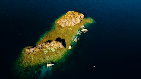
A navigator does not look for a tiny speck of land in a vast ocean. Instead, they look for the “expanded” island. This includes the flight radius of birds (up to 50 miles), the change in water color caused by shallow reefs, and the presence of “land clouds”—stationary clouds that sit above islands due to heat convection. By identifying these signs, the “target” becomes hundreds of miles wide rather than just a few.
Expert Advice for Modern Mariners
-
Maintain Situational Awareness:
Even with GPS, practice identifying the direction of the sun and moon to keep your internal compass calibrated. -
Study Wave Dynamics:
Observe how waves change shape near shorelines; this skill is invaluable if electronics fail during coastal approaches. -
Night Vision Preservation:
Ancient navigators avoided bright lights to maintain their ability to see faint stars. Use red light on deck to preserve your natural night vision.
Frequently Asked Questions (FAQ)
-
Is traditional navigation still accurate enough for long voyages?
- Yes. Modern voyages by vessels like the Hokule’a have proven that traditional wayfinding can successfully guide a ship across thousands of miles of open ocean to a specific island target without any electronic instruments.
-
How do navigators stay awake on long journeys?
- Navigators often enter a state of “active rest” or micro-sleeping, where they remain attuned to the motion of the boat even while dozing. On larger voyages, multiple trained wayfinders may share the duty.
-
What happens if it is cloudy for several days?
- The navigator relies entirely on the “feeling” of the swells. Because swells are consistent and generated by distant weather systems, they remain reliable markers of direction even when the sky is completely obscured.
-
Can anyone learn wayfinding, or is it a lost art?
- While it was once a dying art, the “Polynesian Renaissance” of the 1970s revitalized the practice. Today, schools in Hawaii, Micronesia, and New Zealand teach these ancient techniques to a new generation of mariners.
-
How does a navigator determine latitude without a sextant?
- They use “Zenith Stars.” By knowing which star passes directly through the center of the sky at their home island versus their destination, they can judge their north-south position based on the star’s angle relative to the horizon.