Mountains appear to be the very definition of stillness and permanence, ancient sentinels standing against the passage of time. However, this perception masks a profound and dynamic reality. Mountains are not static objects but are in a constant state of flux, akin to colossal, slow-motion ocean waves. They are born from the immense power of plate tectonics, sculpted by the relentless forces of erosion, and serve as complex, interconnected systems that dictate regional climates, cradle unique ecosystems, and govern the flow of water for entire continents. This guide explores the intricate life of mountains, from their geological origins and structural composition to their critical role as ecological ladders and global water towers.
The Geological Heartbeat: How Mountains Are Born and Evolve
The creation and evolution of mountains are governed by processes that operate on geological timescales, spanning millions of years. The primary engine behind mountain formation, or orogeny, is the movement of Earth’s tectonic plates. These colossal slabs of lithosphere are constantly shifting, and their interactions are responsible for the planet’s most dramatic topographical features. The apparent stillness of a mountain range is merely a snapshot in a continuous cycle of uplift and decay.
Tectonic Forces: The Engine of Orogeny
Mountain ranges are primarily formed at convergent plate boundaries, where two tectonic plates collide. The nature of this collision dictates the type of mountain that is formed.
- Continental-Continental Collision: When two continental plates collide, neither can be easily subducted due to their similar low density. Instead, the immense pressure causes the crust to buckle, fold, and fault, thrusting rock upwards to form massive mountain ranges like the Himalayas, which resulted from the collision of the Indian and Eurasian plates.
- Oceanic-Continental Collision: When a denser oceanic plate collides with a continental plate, it is forced to slide beneath it in a process called subduction. This process leads to the formation of volcanic mountain ranges, such as the Andes, as magma generated from the melting subducting plate rises to the surface.
- Oceanic-Oceanic Collision: The convergence of two oceanic plates also results in subduction, leading to the formation of volcanic island arcs, which are essentially underwater mountain ranges that have breached the ocean’s surface.
The Mountain Lifecycle: Uplift vs. Erosion
A mountain’s existence is a constant battle between two opposing forces: tectonic uplift and erosion. While tectonic forces push the crust upwards, weathering and erosion work tirelessly to wear it down. This dynamic balance shapes the mountain’s morphology over its lifespan. Young mountain ranges, like the Alps, are typically high and jagged, indicating that the rate of uplift currently outpaces the rate of erosion. In contrast, older ranges, such as the Appalachians, are lower and more rounded, showing that erosion has been the dominant force for millions of years, gradually grinding down the peaks.
Isostasy and the Deep Roots of Mountains
Mountains have deep “roots” extending into the mantle, much like an iceberg has most of its mass below the water. This is due to the principle of isostasy, which describes the gravitational equilibrium between the Earth’s crust and mantle. The immense mass of a mountain range depresses the lithosphere into the more fluid asthenosphere below. As erosion removes material from the mountain’s peak, the reduced weight causes the entire crustal block to rebound upwards, a process known as isostatic uplift. This ensures that even as a mountain erodes, its core can continue to rise, prolonging its existence for hundreds of millions of years.

The Architecture of Altitude: Vertical Geology and Structure
The internal structure and external appearance of mountains are a direct reflection of the rocks they are made of and the stresses they have endured. From sheer granite cliffs to vast slopes of fragmented rock, these features tell a story of immense pressure, temperature, and the constant pull of gravity. Understanding this architecture is key to deciphering a mountain’s history and its present-day environment.
Understanding Rock Mechanics: Stress, Strain, and Fracture
Rocks that form mountains are subject to incredible stress from tectonic forces. This stress causes the rock to deform, a process known as strain. Initially, a rock might deform elastically, but once its elastic limit is surpassed, it will either fold (ductile deformation) or fracture (brittle deformation). This behavior is why we see massive, sweeping folds in some mountain ranges and sharp, angular faults in others. The sheer vertical faces of cliffs are often the result of large-scale fracturing, where massive blocks of rock have broken away along planes of weakness.
The Formation of Cliffs and Vertical Enclosures
Cliffs and other vertical rock faces are among the most dramatic mountain features. They form when geological uplift exposes resistant rock layers. Erosion, particularly from water and ice, then exploits weaknesses such as joints and faults, undercutting less resistant layers and causing overlying rock to collapse. This process, known as mass wasting, is a powerful sculptural force. The resulting “vertical enclosure” creates a unique microenvironment, distinct from the surrounding slopes, and presents a formidable barrier to both flora and fauna.
Periglacial Landscapes: The Realm of Frost and Stone
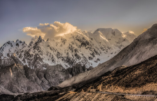
At high altitudes, above the permanent snowline, lies the periglacial zone. This environment is dominated by the freeze-thaw cycle of water. Water seeps into cracks in the rock, freezes, expands, and widens the cracks in a process called frost shattering or frost wedging. Over countless cycles, this process breaks down solid rock into angular fragments. These fragments accumulate on slopes to form vast fields of loose rock known as scree or talus. These “ashes of the mountains” can form entire landscapes that appear barren but are a testament to the powerful, persistent action of ice, creating a unique and challenging habitat.

The Vertical Ladder of Life: Mountain Ecology and the Treeline
As altitude increases, environmental conditions change dramatically. Temperature drops, atmospheric pressure decreases, and exposure to wind and solar radiation intensifies. This rapid environmental gradient creates distinct ecological bands, or life zones, stacked vertically up the mountain. This phenomenon, known as vertical zonation, means that ascending a tall mountain can be like traveling thousands of kilometers in latitude, from temperate forest to arctic tundra in just a few thousand meters of elevation.
What is Vertical Zonation in Ecology?
Vertical zonation is the layering of ecosystems at different altitudes. At the base of a mountain, one might find lush deciduous or coniferous forests. As one ascends, these give way to hardier subalpine forests, characterized by species adapted to colder temperatures and shorter growing seasons. Higher still, the forest abruptly ends, giving way to alpine meadows and eventually to barren rock and ice. Each zone supports a community of plants and animals specifically adapted to its unique conditions.
The Mystery of the Alpine Treeline: A Zone of Struggle
The alpine treeline is one of the most distinct ecological boundaries on Earth. It is the highest elevation at which trees can survive. This is not a sharp line but rather a transition zone where trees become progressively shorter and more gnarled (a form known as krummholz) before disappearing entirely. The existence of the treeline is not caused by a single factor but by a combination of environmental stresses.
- Temperature Stress: The primary factor is the length and warmth of the growing season. Trees require a certain soil temperature for root activity and a certain air temperature for photosynthesis and growth. Above the treeline, the growing season is simply too short and too cold to support the metabolic processes of a large, woody plant.
- Mechanical Stress: High winds at altitude can physically damage trees, break branches, and dry them out through a process called desiccation. Heavy snowpack can also crush and bury young saplings.
- Soil Conditions: High-altitude soils are often thin, nutrient-poor, and unstable, making it difficult for trees to establish a strong root system.
Life Above the Trees: Alpine Meadows and Tundra
Beyond the treeline lies the alpine zone. This environment, which appears desolate from a distance, is home to a rich diversity of specially adapted life. Plants in this zone are typically low-growing perennials, such as grasses, sedges, and cushion plants, which are adapted to withstand cold temperatures, high winds, and a short growing season. These alpine grasslands and tundra are crucial ecosystems, providing forage for mountain-dwelling animals and helping to stabilize fragile high-altitude soils.

The Great Water Towers: Hydrology and Climate Influence
Mountains play a fundamental and irreplaceable role in the global hydrological cycle. They act as “water towers,” intercepting atmospheric moisture, storing it as snow and ice, and releasing it gradually to downstream regions. This function is critical for sustaining rivers, agriculture, and populations far from the mountains themselves. Furthermore, their very presence dramatically alters regional and even continental climate patterns.
The Rain Shadow Effect: How Mountains Create Deserts
One of the most significant climatic influences of mountains is the rain shadow effect. When moist air from an ocean or large body of water encounters a mountain range, it is forced to rise. As the air rises, it cools and condenses, causing precipitation to fall on the windward side of the mountains. This side often supports lush, green forests. By the time the air mass crosses the mountain crest and descends on the leeward side, it has lost most of its moisture. The descending air warms and expands, further reducing its relative humidity. This creates an arid or semi-arid region—a “rain shadow”—on the downwind side. This is why many of the world’s great deserts, such as the Gobi Desert (in the rain shadow of the Himalayas) and the Atacama Desert (in the rain shadow of the Andes), are located adjacent to major mountain ranges.
Glaciers and Snowpack: Earth’s Frozen Reservoirs
At high elevations, precipitation often falls as snow, accumulating over years to form glaciers and seasonal snowpack. These frozen bodies act as natural reservoirs. The seasonal snowpack melts in the spring and summer, providing a reliable source of fresh water for rivers and streams precisely when it is most needed for agriculture in the lowlands. Glaciers provide a longer-term storage solution, releasing meltwater throughout the warm season and providing a crucial buffer during years of low rainfall. The Colorado River, for example, is heavily dependent on the snowmelt from the Rocky Mountains.
Tectonic Blueprints: How Geology Shapes River Systems
The geological structure of a mountain range, including its faults, fractures, and folds, often provides the blueprint for entire river networks. Water naturally follows the path of least resistance, exploiting these lines of weakness in the Earth’s crust. For example, the Great Rift Valley in Africa is a massive tectonic feature—a divergent plate boundary—that has fundamentally shaped the continent’s hydrology, creating a series of lakes and guiding the flow of major rivers. The very structure of the land, dictated by deep geological forces, designs the water systems that life depends on.

Case Studies: Tectonic and Hydrological Interplay in Action
Examining specific regions reveals how the grand principles of geology and hydrology interact to create unique and complex landscapes. The Great Rift Valley in Africa and the Colorado Plateau in North America are prime examples of how deep Earth processes sculpt the surface and dictate the flow of water over millions of years.
The Great Rift Valley: A Continental Scale Water System
The East African Rift is a place where the African continent is actively being torn apart. This “crustal fracture” has created a vast depression, or rift valley, flanked by highlands and volcanoes. This tectonic activity has profoundly influenced the region’s hydrology. The valley floor is dotted with a chain of lakes, many of which are endorheic (lacking an outlet to the sea), making them sensitive indicators of regional climate. The elevated shoulders of the rift intercept moisture, creating wetter climates that feed some of Africa’s most important rivers, including the Nile. Here, the deep geological process of rifting has literally designed a water system on a continental scale.
The Colorado Plateau: A Story of Uplift and Incision
The Colorado Plateau is a massive, relatively stable crustal block that experienced significant, broad uplift millions of years ago. This uplift raised the entire region by thousands of feet without significant folding or faulting. This event set the stage for one of the world’s most spectacular examples of river erosion. As the land rose, the Colorado River and its tributaries maintained their course, carving downwards into the rising rock layers. The result is a landscape of deep, steep-walled canyons, including the Grand Canyon. The “frozen torrents” of geological time—the slow but powerful uplift—were met by the relentless power of flowing water, creating a landscape that showcases the interplay between tectonic uplift and hydrological erosion.
Frequently Asked Questions (FAQ)
- Q1: Why are mountains considered “slow-motion ocean waves”?
- This analogy describes the geological timescale of mountain building (orogeny) and erosion. Just as ocean waves rise and fall, mountains are pushed up by tectonic forces over millions of years and are then slowly worn down by weathering and erosion. The entire process is a continuous cycle of uplift and decay, making them dynamic structures rather than static landforms.
- Q2: What is the single most important factor that determines the alpine treeline?
- While multiple factors contribute, the most critical is growing season temperature. Trees require a minimum soil and air temperature for a long enough period to perform photosynthesis, grow, and reproduce. Above a certain elevation, the average temperatures during the growing season are too low to sustain the life of a large, woody plant, effectively creating the treeline.
- Q3: How can the highest mountains be next to the driest deserts?
- This is caused by the rain shadow effect. As moist air is forced to rise over a mountain range, it cools and releases its moisture as rain or snow on the windward side. After crossing the mountains, the now-dry air descends, warms up, and absorbs moisture from the land on the leeward side, creating arid or desert conditions. The Andes and the Atacama Desert are a classic example.
- Q4: Do mountains ever stop growing?
- Yes, the growth of a mountain range stops when the tectonic forces causing the uplift cease or slow down significantly. Once this happens, the forces of erosion become dominant. Over millions of years, erosion will wear the mountains down, reducing their height and rounding their peaks, as seen in ancient ranges like the Appalachians.
- Q5: What is the difference between scree and soil?
- Scree (or talus) consists of physically weathered, angular rock fragments that accumulate at the base of cliffs, primarily through processes like frost shattering. It is essentially broken rock with very little organic material. Soil, on the other hand, is a complex mixture of minerals, organic matter, water, and air, formed over long periods through both physical and chemical weathering, as well as biological activity. Scree is the raw mineral component, while soil is a living, developed medium.